Custom Data & Consulting
Chicago Cityscape has spent years building one of the most comprehensive property and zoning databases in the Chicago area. We put that database to work for you — delivering data extracts, custom analysis, and expert consulting tailored to your project.
Tell us about your projectCustom data extracts
Need data for a specific geography, property type, or time period? We can pull it for you.
Our database covers over 1.8 million Cook County properties and includes zoning, ownership, sales history, permit records, tax assessment values, exemptions, and more. Instead of spending hours collecting and cleaning data from multiple government sources, you get a single, ready-to-use file.
Past extracts we've delivered include:
- Property ownership records for a specific neighborhood or custom boundary
- Vacant land parcels filtered by zoning district and proximity to transit
- Property tax history for a portfolio of PINs
- Geocoded address lists matched to parcels and zoning
- Cook County parcel data with current Chicago zoning appended
Extracts are delivered as CSV (spreadsheet-ready) or GeoPackage/Shapefile (GIS-ready), depending on your needs.
Request a custom extractZoning assessments & hearing reports
Going before the Plan Commission or Zoning Board of Appeals? We prepare clear, well-researched zoning reports for applications.
Our reports draw on Chicago Cityscape's deep zoning database for Chicago — including current zoning, zoning history, nearby land uses, permit activity, and context from surrounding properties. We can prepare analysis and documentation that helps attorneys, developers, and community organizations make their case.
We can help with:
- ZBA reports — Variance and special use applications, with supporting data on the subject property and its context
- Plan Commission submissions — Planned development analysis, neighborhood context maps, and land use summaries
- Zoning due diligence — Pre-purchase or pre-application assessments of what can be built on a property under current and proposed zoning; useful for lenders during closing
- Rezoning support — Data and mapping to support a rezoning petition or community engagement process
Consulting & custom development
Need a feature that doesn't exist yet, or want to integrate Chicago Cityscape data into your own tools? We build it.
We've worked with planning organizations, policy groups, and real estate firms to deliver custom tools built on our data infrastructure. If your workflow requires something beyond what our standard membership offers, we can scope and build it.
Examples of past work:
- Transit-oriented development (TOD) eligibility API for Metropolitan Planning Council
- Bulk geocoding of addresses against Cook County parcel data
- Custom notification systems for permit activity in a specific geography
- Data integration into a client's existing GIS or database environment
We're also open to proposals for new features that would benefit Chicago Cityscape members broadly. If you have a research need, let's talk.
Discuss a consulting projectAvailable datasets
In addition to custom work, we offer several ready-made datasets for immediate purchase.
Cook County property data
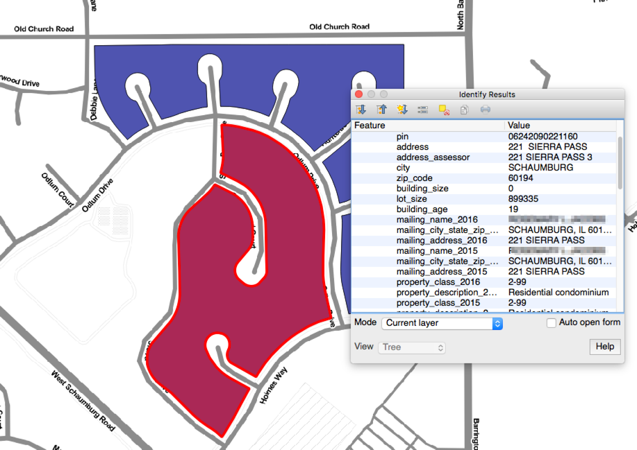
Details for over 1.94 million parcels, properties, and condos in Cook County — including property tax bill values (2009–2023), assessment values, appeals status, exemptions, building size, building age, and lot size. Every property includes geometry, ready for GIS analysis. This is the only way to get the full dataset.
The dataset includes
- Appeals and exemptions information for 2012–2026
- Property class and descriptions for 2014–2026
- Taxpayer name & address for 2014–2026
- Assessment value data for 2015–2026
- Property sales data from 2013 to present
- Condo unit number in the
address_assessorfield - Building age derived from
property_tax_yearminus thebuilding_agefield
* Building size, age, and lot size are available where the Cook County Assessor has collected them — not all properties have this detail.
Delivered as a GeoPackage (GIS) and CSV (spreadsheet). Because the compressed file is 1.3 GB, we send a personal download link.
Options
- Vacant parcels only (~86,136 parcels), $199.00
- Geographic subset with additional fields (such as current Chicago zoning) — contact us
Download samples
GeoPackage (opens in QGIS and ArcGIS) | CSV — samples may be outdated but show the available fields
Inquire about purchasingCity of Chicago-owned land
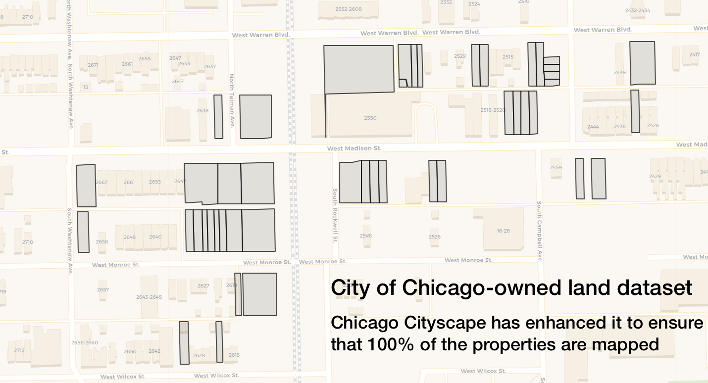
Chicago Cityscape offers an enhanced dataset and map of City of Chicago-owned land. The City's publicly available dataset has many unmapped properties due to PIN changes over time — we've corrected those so that 100% of the properties in the dataset are mapped.
Learn about the original dataset's limitations and the ways to purchase Chicago-owned land.
Inquire about purchasingMaps by layer
Purchase individual map layers — $50 each, or $400 for all. Each purchase includes an ESRI Shapefile and a GeoJSON file.
We have more maps and data available. View our full index on GitHub, then contact us to obtain a copy.