2002 W 18th St
2002 W 18th St, Chicago, IL
Cook county
PIN: 17-19-301-047-0000
Property Report (PIN-based)
Property Reports are checked for updates daily - this report was generated on 3/29/2026 11:33
Demo This Property Report is unlocked for sampling and accessible by anyone - share widely
Hot search This Property Report is in the top 2% of lookups in the last 7 days
The PIN 17-19-301-047-0000 is selected
Additional Snapshots
Environmental & Land Use
Tree coverage, flood risk, solar energy funding, building energy data, and inspections, permits, and storage tanks.
Environmental Snapshot
2002 W 18th St
Logistics
Locate transit & transportation assets, cargo facilities, commute statistics, IDOT jurisdiction, and job clustering.
Logistics Snapshot
2002 W 18th St
Housing & Landmarks
Affordable housing data, Chicago Historic Resources Survey, and landmarks data.
current zoning is C1-2
2002 W 18th St is in Lower West Side
and zoned C1-2 on a ~6,030 square foot lot .
Our copy of the zoning map was last updated
March 9, 2026, with map changes made through March 4, 2026
Additional districts
in the Multi-Unit Preservation (Pilsen) District The Multi-Unit Preservation (Pilsen) District consists of all parcels zoned RT-4, RM-4.5, RM-5, RM-5.5, RM6- and RM-6.5 and within the area bounded by: 16th Street, Newberry Avenue, 18th Street, Peoria Street, Cermak Road, Racine Avenue, 21st Street, Laflin Street, Cermak Road, the alley next east of and parallel to Western Avenue, the alley next north of and parallel to Cermak Road, the alley next east of and parallel to Western Avenue, 19th Street, Western Avenue, the alley next north of and parallel to 18th Place, Leavitt Street, the alley next north of and parallel to 18th Street, Hamilton Avenue, the alley next north of and parallel to the alley next north of and parallel to 18th Street, a line 126 feet west of and parallel to a line 126 feet west of and parallel to Hoyne Avenue, a line 163 feet north of and parallel to the alley next north of and parallel to 18th Street, 17th Street and Wood Street. Adopted by Chicago City Council on January 27, 2021.
This area has a building demolition surcharge tax pilot program until April 1, 2024 (MCC 2-44-135). Boundaries are defined in MCC 17-7-0580. Keyword: predominance
View a map of Multi-Unit Preservation (Pilsen) District
Refer to ordinance O2020-6207
Chapter 17-7 Overlay Districts Municipal Code of Chicago has more details on how these special districts affect development and construction.
not in the Lakefront Protection District
See a map of the Lakefront Protection District
Liquor moratoriums
Checking the map...
Maps of nearby liquor moratoriums
Municipal Code of Chicago 4-60-020 governs restricted areas and distances to potentially sensitive uses.
Housing at 2002 W 18th St
ADU eligibility check
Sign in to your free account to see if ADUs are allowed here, or sign up for a free account.
Opportunities for additional housing
Learn more about what we call #UnusedZoningCapacity.
Ground floor housing Converting ground floor space to residential use may be possible via administrative adjustment. Learn more.
Unused FAR This property's zoning district allows a building area up to 13,267 s.f. but the current building area is 6,000 s.f. Enlarge the building, or build a larger building, without having to get an upzone.
Dwelling unit calculator
This location's zoning district is C1-2
- 6 dwelling units allowed
- This number doesn't consider ADU eligibility. - 1 efficiency (studio) unit can be built, in addition to 5 dwelling units (total of 6 units). The C1-2 zoning district allows up to 20% of total units to be efficiency (studio) units.
- 6 SRO units allowed
Limits on efficiency units do not apply to transit-served developments within 660 feet of a transit facility (station or selected bus corridor).
- Dwelling units: The parcel lot area is 6,030 sq.ft. x 2.2 FAR, making the max floor area 13,267 sq. ft. The minimum lot area per dwelling unit is 1,000 sq.ft.: 6,030/1,000 = 6 units
- Efficiency units: The maximum amount of efficiency units is 20%. The remainder, for dwelling units, is 80%. The blended minimum lot area (MLA) is 940 (700 x 20% + 1000 x 80%). The total number of units is 6 (area of 6,030/940 MLA). Lastly, the maximum number of efficiency units is 6 (total number of units) x 20% (maximum amount), or 1. The number of dwelling units allowed is 6 (total units) - 1 (efficiency units) = 5. (Per 17-1-0605-B, all fractional housing units are rounded down.) Note: A property in a B, C, or D zoning district and within 660 feet of a CTA or Metra station entrance or exit, or an eligible CTA or Pace bus corridor, has no maximum number of efficiency units standard.
- SRO units: The parcel lot area is 6,030 sq.ft. x 2.2 FAR, making the max floor area 13,267 sq. ft. The minimum lot area per SRO unit is 1,000 sq.ft.: 6,030/1,000 = 6 units (the Zoning Administrator will verify that these are bona fide SRO [single room occupancy] units)
These are automated estimates and not a guarantee. Lot size, height limit, and setbacks affect the number of buildable dwelling units; other factors and exemptions can affect these automated estimates. Some below grade space will not count against allowable floor area.
Transportation Demand Mgmt. (TDM)
Calculator options
Note: Recalculating will not re-assess ADU status nor minimum density standards in "Community Preservation" areas.
Change the zoning district
Lot size (s.f.)
Use the field below to recalculate the number of dwelling & efficiency units allowed based on a different lot size.
Efficiency units
Expand to adjust efficiency unit calculation
This location is close enough to transit that the limit on efficiency units is waived in B, C, and D zoning districts. The C1-2 zoning district's efficiency unit limit is 20%.
Use the field below to recalculate the number of dwelling & efficiency units allowed based on a percentage of efficiency units you prefer.
Developments allowed in C1-2
Developments are "zoning uses" that comprise buildings, businesses, and other activities that are allowed here because of the C1-2 zoning classification
Allowed uses summary
Click the link to filter the table
- Permitted/as of right uses
- Special use (SU) required
- Planned Development (PD) required
- Zoning change required
- Reset filter
Suggested ways to use this info
Show suggested ways
- Copy the list into an offering memorandum or online listing
- Print some of the allowed uses on a "for lease" banner to hang on the building
Common uses in C1-2
Small businesses; one or two apartments above; bars and venues
PPA proximity check
In all B and C districts, establishments that require a public place of amusement (PPA) license may not be located within 125 feet of any RS-1, RS-2 or RS-3 district.
Check proximityLearn more about this and other PPA distance standards
Zoning Assessment Appendix
Complete zoning assessments & reports
Ad Order a full zoning assessment from Chicago Cityscape Understand what you can build here, pass along key design information to your architect, and learn about parking requirements, historic status, and more. Fee ranges from $1,000 to $1,800 depending on property size, project scope, and deadline. You must provide a survey.
Zoning standards for C1-2 (C)
View this property in 3D Building Visualizer
- For the latest updates, open the Chicago Zoning Code.
- Much of the plain language comes from Second City Zoning.
Open the zoning matrix for this location
Parking requirements
The City of Chicago requires off-street car parking for nearly all buildings and developments, as well as new businesses. We have distilled the most important parking requirements for residential developments. Parking requirements for non-residential developments are too complex to be simplified here as they are based on the type and size of the business or development being proposed.
TOD parking rules Transit-Served Location ordinance parking rules apply here because 2002 W 18th St is in a TOD area. Generally, no car parking is required. It's capped at 1:1 in B, C, and D districts. Developments in Downtown zoning districts or served only by Metra stations may still have a 50% parking requirement, that can be waived via administrative adjustment.
- Review our Connected Communities guide for details about requirements for residential and non-residential developments.
- TOD Status adds further details
Parking notes
Parking requirements for developments with non-residential uses require a zoning assessment that's specific to the proposal. Contact us to order a customized zoning assessment.
Review the TOD Status below to determine if this location is eligible, based on its proximity to transit, to take advantage of a reduced off-street car parking requirement.
The Chicago Zoning Ordinance allows for off-site shared or cooperative parking for situations when off-street parking cannot be provided on the same property.
The corresponding Logistics Snapshot for 2002 W 18th St provides more information and maps about transit stops & stations nearby
Additional zoning standards
TDM guidelines
This property meets the TDM location criteria
New construction developments in a B, C, or D zoning district within 1/2 mile of a CTA or Metra rail station must comply with the Chicago Department of Transportation's TDM guidelines. Transportation Demand Management is the name of policies and strategies that collectively aim to influence personal transportation choices and reduce the prevalence of traffic-causing single-occupancy vehicle trips.
Learn more about TDM in our Knowledge Base.
Short-term rentals
No short-term home rental ban here, because in Chicago they're only possible in RS-1, RS-2, and RS-3 zoning districts (more info & full map).
- Check "Developments in C1-2" above to see if Shared Housing, Vacation Rental, and Bed and Breakfast uses are allowed here.
- Check the House Share Prohibited Buildings list.
Signs
Rules about signs are complicated. Refer to 13-20-550 to determine when a sign permit is required (this section also addresses murals and temporary and "for lease" signs).
Affordable housing requirements
Affordable Requirements Ordinance (ARO) v.2021
2002 W 18th St is in the Community Preservation area.
In-lieu fee for Option 1: $155,344 - see fees for all Options
Review the rules for the Community Preservation area in the ARO Matrix.
About the ARO 2021 changes
Chicago City Council adopted a revised Affordable Requirements Ordinance in April 2021, which is effective for entitlements obtained on or after October 1, 2021. Building permit applications for projects that obtained entitlement before October 1, 2021, have the ARO 2015 rules applied and have until October 1, 2025, to be submitted to stay under ARO 2015 rules.
ARO compliance is required for residential projects that receive a zoning change, TIF money, or city-owned land, and add or build 10 or more units.
All of Chicago is organized into one of five areas with different requirements (view full ARO 2021 map ):
- Pilsen & Little Village pilot area (expired at the end of 2023)
- Downtown area
- Inclusionary Areas
- Community Preservation Areas
- Low-Moderate Income Areas
ARO regulations
- 2-44-085 in the Municipal Code of Chicago
- ARO matrix (for proposed rental housing)
- Cityscape's summary of ARO 2021
- View current AMI chart - Area Median Income is used to determine eligibility for affordable housing rentals and purchases.
- Near North/Near West and Milwaukee Corridor pilot areas sunsetted in October 2021; read about them in the Municipal Code at 2-44-090 and 2-44-100, respectively
House preservation area
This location is within a multi-family preservation area.
Chicago adopted two areas in February 2021 to inhibit teardowns and deconversions of 2-flats and 3-flats. These exist around the Bloomingdale Trail/606 and in part of Pilsen. Per MCC 2-44-135, the surcharge is in effect through December 31, 2029.
This location is in the Multi-Unit Preservation (Pilsen) District (map).
Generally in this pilot area, in zoning districts with an "RT-4" classification or higher, a minimum density of three units per property is required for redevelopment (depending on the lot size and zoning district's minimum lot area per unit standard). This also prohibits deconversions to a single-detached or two-flat. Read ordinance O2020-6207.
There is a surcharge for residential demolition permits issued in this area. Ordinance O2021-746 added 2-44-135 to the Municipal Code of Chicago and establishes surcharges of $15,000 for the demolition of a detached house, townhouse, or two-flat, and $5,000 per dwelling unit for the demolition of a multi-unit residential building (until December 1, 2024).
Fair Market Rent
Fair Market Rent is the amount of rent that a local housing authority will pay a landlord when a tenant brings a Housing Choice Voucher to pay rent.
Chicago zoning history
Our copy of the Chicago zoning map was last updated March 4, 2026 Our earliest zoning map is from September 4, 2003. *The "Date changed" is when the zoning district's boundaries were modified by City of Chicago staff; sometimes it reflects when this address was rezoned.
Zoning change advice
Review other zoning changes in the 25th Ward, Byron Sigcho-Lopez.
Sports betting
O2021-3243 introduced zoning standards for the placement of sports betting facilities "by right" inside of a casino, at an inter-track wagering facility, or inside of within five blocks of five named stadiums.
Click the button below to find the nearest stadium.
Historical maps locators
Chicago Cityscape can help locate this address on a historic map that is created and hosted by other organizations.
Learn more about these historical maps in our Knowledge Base
80 Acres
Each 80 Acres map shows 80 acres of Chicago and contains survey information including house numbers and lot dimensions. Also view the City of Chicago's 80 Acres citywide interactive map.
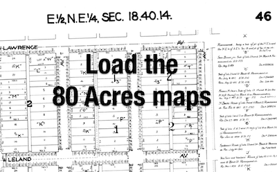 Load the 80 Acres maps locator map
Sanborn maps
Each Sanborn map shows Chicago buildings as they were in the late 1980s and/or early 1990s. Read our Knowledge Base article about these fire insurance maps and other ways to dig up property history.
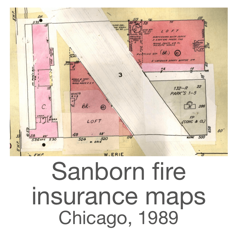 Load the Sanborn maps locator map
Additional Sanborn map eras
The Chicago Public Library provides access to Fire Insurance Maps online (FIMo). Follow these instructions to access historic maps from Sanborn and other insurance companies.
- Sign in to your Chicago Public Library account
and return to this Property Report - Select this link to find maps at 2002 W 18th St
Tax maps
Chicago tax maps, created by Cook County (2021 tax year).
 Load the tax maps locator map
- Look for other years' tax maps on the Cook County Clerk's Tax Map Viewer (map should zoom in on the parcel for this PIN)
- Show this parcel on the CookViewer 3.0 map
Water Books
Historical water distribution maps showing water main locations, sizes, and installation dates from the City of Chicago Department of Water Management. Learn why water books are useful for property research
Data notes: Each PDF is quite large (over 50 MB) and unsuitable for viewing on a phone.
TOD Status for 2002 W 18th St, Chicago, IL
This section is designed for property owners, developers, and businesses to understand the benefits of the Chicago "Transit-Served Location" ordinance (also known as the TOD ordinance). Properties & storefronts in Chicago near train stations – CTA's rapid transit 'L' and Metra's commuter rail – and eligible bus corridors may be eligible for bonuses.
Resources from our Knowledge Base
Cityscape's automated determination
TOD 2002 W 18th St is likely eligible for the benefits of the Transit-Served Location ordinance because of its zoning class (C1-2) and close proximity to transit.
The nearest eligible transit facilities are...
Nearest station entrance/exit
Damen CTA Pink Line station, 1,157 feet away
(direct line). It must be within 2,640 feet.
Benefits & standards
Development at this location is eligible for these project benefits or must comply with these standards (read our summary):
- Less parking required - Minimum parking requirements are eliminated. An administrative adjustment is required for projects proposing greater than 50% of the otherwise required standard.
- Parking cap - Due to being in a rail TOD area, parking for residential is capped at 100% of the chapter 17-10 parking table (per 17-3-308/17-4-0301 and 17-13-1003-EE)
- Driveway standard - Pedestrian Street standards apply here, and require that any driveway or curb cut is approved via administrative adjustment
this location meets the distance requirement first because of a CTA station
Take note
Pedestrian Street design standards apply to new construction here per 17-3-0308(2).
TDM guidelines apply to new construction here per 17-3-0308(5) (learn more).
Maximum distances & Pedestrian Street
show the maximum distance between properties and...
...CTA & Metra stations entrances/exits is 2,640 feet.
...select bus route corridors is 1,320 feet.
Starting September 25, 2025, transit-served location parking relief is available in all zoning districts (learn more).
Pedestrian Streets
P-Street This is not on or within 150 feet of a zoned Pedestrian Street.
Measuring
TOD Status is automatically measured, using GIS, in a direct line between the nearest CTA or Metra station entrance/exit or the centerline of the roadway with the nearest CTA or Pace bus corridor and the closest lot line. These lot lines do not have the accuracy of a survey.
The distance is automatically measured by our mapping system. We have taken steps to ensure high accuracy; a survey and a zoning assessment will provide the most accurate measurements.
Nearby transit walking distances
Nearest CTA or Metra station entrance or exit
Damen CTA Pink Line station
about 2.0 blocks away / 1,301 feet (walking distance) / 1,157 feet (straight line)
Nearest listed bus corridor
Cermak Rd
about 3.3 blocks away / 2,168 feet (walking distance) / 2,040 feet (straight line).
TOD map notes
- View all bus stops and train stations on Logistics Snapshot
- Walking distance is approximate in a city with a street grid. Blocks refer to the 1/8th mile typical block length in Chicago.
- Lines are measured to nearest station entrance or exit; in Chicago, additionally measured to nearest listed bus corridor.
Download the TOD map
Property & Ownership info / 17-19-301-047-0000 / 17193010470000
Our data comes from multiple official sources which are updated at various times; we've programmed our system to attempt to automatically show the latest and best information.
Commercial data
- 6,000 s.f. of building area
- 6,000 s.f. of land area
- 0.075 derived cap rate (multiply by 100)
- 105.39042253547 derived market value per s.f.
- 0.05 derived vacancy rate (multiply by 100)
- 1935, year built
This information comes from the Cook County Assessor's Office model for assessing commercial properties.
Building & site info
Characteristics
Property class
One story non-fireproof public garage (5-22)
Property class options
- Locate nearby properties with the same property class in Property Finder below
- Review a list of all property classes
Parcel dimensions
Upgrade to Cityscape Real Estate Pro or unlock this Property Report to see a map that measures the dimensions of this property.
Taxpayer info
Cityscape Real Estate Pro members can see information about 1 taxpayers associated with this property.
Use the ![]() Illinois Secretary of State business database to find who owns a company.
Illinois Secretary of State business database to find who owns a company.
Taxpayer info for this property was last checked 1/15/2026 and a change was noted.
This is the information on file with the Cook County Treasurer. New owners are required to update their tax bill mailing address.
Property values & sales
2026 tax year
- Total assessed value
- $[missing data for this year]
- Assessment pass
- [missing data for this year]
- Timestamp
- 3/17/2026 16:06
2025 tax year
- Total assessed value
- $106,056
- Assessment pass
- Assessor Certified
- Timestamp
- 3/17/2026 15:55
Property Sales
We don't have any property sales data to show for this property since 2013.
Property sales data
- Property sales are updated multiple times each month.
- View nearby property sales & sales comps
- Use Property Finder to find tax comps
Tax sale info
Checking for tax sales...
Recordings & title info
Upgrade to see recordings
Links to other Cook County databases
Sign in to view the links to other databases.
Upgrade to see property tax history
Taxpayer info for this property was last checked 1/15/2026 and a change was noted.
Upgrade to see appeals history
Similar properties top 5 within ½ mile
Surrounding Places Places that overlap or border 2002 W 18th St
Incentives Checker
? of 43 development & financial incentives and potential CRA credits at 2002 W 18th St, Chicago, IL
Incentives Checker notes
disclaimerChicago Cityscape's determinations for development & financial incentives eligibility are based on geography and are not guaranteed. Only during the application process can your proposed project's eligibility be certified; many incentives administrators advise contacting them to discuss a project's eligibility prior to submitting an application.- In the Incentive type column, "dbe" stands for "Disadvantaged Business Enterprise", which includes MBE (minority owned) and WBE (woman owned) statuses.
- The City of Chicago has a debt waiver program that can be used to selectively waive the debt on vacant or abandoned properties that will be redeveloped or revitalized. See 2-44-140 in the Municipal Code of Chicago or contact your agent in the Chicago Department of Housing for details.
Knowledge Base: Learn about the different ways to use Incentives Checker, in Property Report, Place Report, and Property Finder.
Learn about how incentives are used
- Read the CMAP March 2022 report about use of incentives in Chicagoland.
- Metropolitan Planning Council has analyzed the use of six incentives in Chicago to determine how equitably they've been distributed.
People who can advise about incentives
- Johnson Research Group. Johnson Research Group. JRG can help with establishing TIF districts, preparing requests for TIF assistance and other incentives, financial gap analyses, financial feasibility studies in support of bond/note issuances, review of development pro formas and budgets, fiscal and economic impact analyses. Contact Ann Moroney.
- SB Friedman. SB Friedman can support evaluating available incentives, assisting with pre-development analyses and preparing pro formas, preparing applications for financial assistance to the Illinois Housing Development Authority and municipalities for affordable housing developments in Chicago and elsewhere. SB Friedman can also help with applications for TIF assistance outside Chicago. Contact Fran Rood.
- Development Planning Partners. Development Planning Partners provides market analysis, market studies, and community development services for public and private sector clients. They assist with understanding market conditions, assessing the potential of development projects, and planning for growth and investment. Contact Zach Lowe.
Cannabis Compliance
Review potential conflicts around 2002 W 18th St, Chicago, IL
What's allowed
Cannabis dispensaries are allowed
Cannabis cultivation is not allowed
Cannabis processing & craft growing are allowed
This property is not in a restricted precinct; check the Chicago City Clerk's website to see if there is an active petition or a notice of intent to petition in this precinct. (Info last checked 2/21/2025.)
Amenities & Social infrastructure near 2002 W 18th St, Chicago, IL
Find schools, bars, restaurants, libraries, community centers, parks, and grocery stores, all within walking distance
Amenities & Social infrastructure is part of Cityscape Real Estate Pro membership. Read about our different membership options.
Buildings data
New construction, renovation, demolition, and other projects at or near 2002 W 18th St 4 permits since 2006
Building permits found here or nearby
Data for Chicago building permits is available from 2006 to present
Sign in to your account to view them, or you can instantly create a free account
Pending building permit applications in Chicago
Showing building footprints at or near 2002 W 18th St updated August 13, 2024
Building footprints found here and nearby
Sign in to your account to view them, or you can instantly create a free account
Showing a sample of reports to 311 at or near 2002 W 18th St about basement flooding, vacant buildings, fly dumping, and potential building violations
Notes about 311 reports
Some reports to 311 may not be shown because they were not mapped during the intake. They have no address and we cannot map them. Data is available for reports made to 311 since December 18, 2018.
Report a vacant or abandoned building on Chicago's 311 website.
Say more about basement flooding reports
Not every homeowner reports to Chicago's 311 system when their basement is flooding (report a flooded basement). According to the Illinois Urban Flooding Awareness Act report of 2015, "there is hesitancy on the part of property owners to report or disclose flooding issues typically due to a concern that it would lessen the property value" (page 73).
Unreported basement flooding has community-wide impacts: "Renters are often uninformed of their risk. There are multiple consequences of not reporting flood issues: new owners do not have the information to mitigate potential flooding and may be caught unaware; renters may experience unexpected losses; communities do not have complete information to develop plans." (page 73).
Find additional links about water, climate change, and flooding on our Environmental Snapshot.
Violations data
Building violations at or near 2002 W 18th St (since 2006) 1 recent 1 violation since 2006
Building violations found here or nearby
Data for Chicago building violations is available from 2006 to present
Sign in to your account to view them, or you can instantly create a free account
Administrative hearings (a kind of court) for building violations at or near 2002 W 18th St
Violations for bank-owned buildings at 2002 W 18th St (the bank may not currently own the property)
Leads
Businesses
Licenses
Showing a sample of business licenses at or near 2002 W 18th St 3 active 48 licenses since 2006
Businesses
Showing a sample of currently-licensed businesses at or near 2002 W 18th St
Note that 4,563 businesses licensed in Chicago (out of 55,301 active licenses) cannot be mapped at this time.
Business resources
Site Selector & Chicago Zoning Map (with liquor moratoriums)
Review Incentives Checker above to identify what financial & development incentives might be able.
Projects + zoning changes
Proposed Projects
Showing a sample of Chicago ordinances and zoning changes near 2002 W 18th St
Proposed Projects is updated monthly and adds 20-30 construction projects each month (except every August) for proposals that require a Chicago zoning map change (since January 2020).
Switch to Zoning changes + Ordinances to see all other zoning change proposals.
Proposed projects found here or nearby
Sign in to your account to view them, or you can instantly create a free account
Proposed TIF-funded projects
Showing a sample of projects proposed to be funded by TIF money near 2002 W 18th St
Zoning changes & Ordinances
Zoning changes, Planned Developments, Chicago-owned property sales, new landmarks, and property tax incentives & abatements at or near 2002 W 18th St data since January 2011
Ordinances found here or nearby
Sign in to your account to view them, or you can instantly create a free account
Zoning Board of Appeals
Showing a sample of Zoning Board of Appeals decisions
The data starts in the 1970s, is updated several times monthly, and includes information about variations, special uses, and administrative adjustments heard by the Chicago Zoning Board of Appeals (ZBA)
ZBA notes & filters
Decisions that are continued to another month may not have the latest judgment information. In the same vein, some decisions may be listed multiple times if they were continued.
18,414 total ZBA decisions | 105 in 2026 | 541 in 2025 | 10,670 with applicant/description details | 20,197 categorized
Public place of amusement (PPA)
PPA + RS zoning districts: see 17-3-0301 in the Chicago zoning code.
Filter by category
Hold Ctrl/Command to select multiple categories and find decisions that match any of the selected categories
show Zoning Stats & Maps
Statistics
Review statistics about zoning changes in Lower West Side
Active developers & attorneys
Get a list of developers and attorneys who are active in Lower West Side
Zoning Map Explorer
See a detailed view of the Chicago zoning map focused on Lower West Side
ChiStreetWork
Find current and upcoming street work, from various City departments, ComEd, Peoples Gas, and others (the City of Chicago owns ChiStreetWork)
Properties
Property Finder filter for specific properties, show tax sales, and get tax comps
Parcels & properties within 1 block (1/8 mi) of the lot lines of PIN 17-19-301-047-0000 (2002 W 18th St)
Parcels & properties found here and nearby
Sign in to your account to view them, or you can instantly create a free account
Property Sales sales comps
Showing property sales & purchases in Cook County in 2013-2026 near 2002 W 18th St PIN: 17-19-301-047-0000
Property transactions found here and nearby
Sign in to your account to view them, or you can instantly create a free account
Report Product ID as_fb8ac9c56684a62c8c63427163a56663