A professor at an out of state university asked this question: The land area for the Central Business District map on Chicago Cityscape is reported as 4.47 square miles, but the Wikipedia page for Loop says 1.58 square miles.
Here’s the answer:
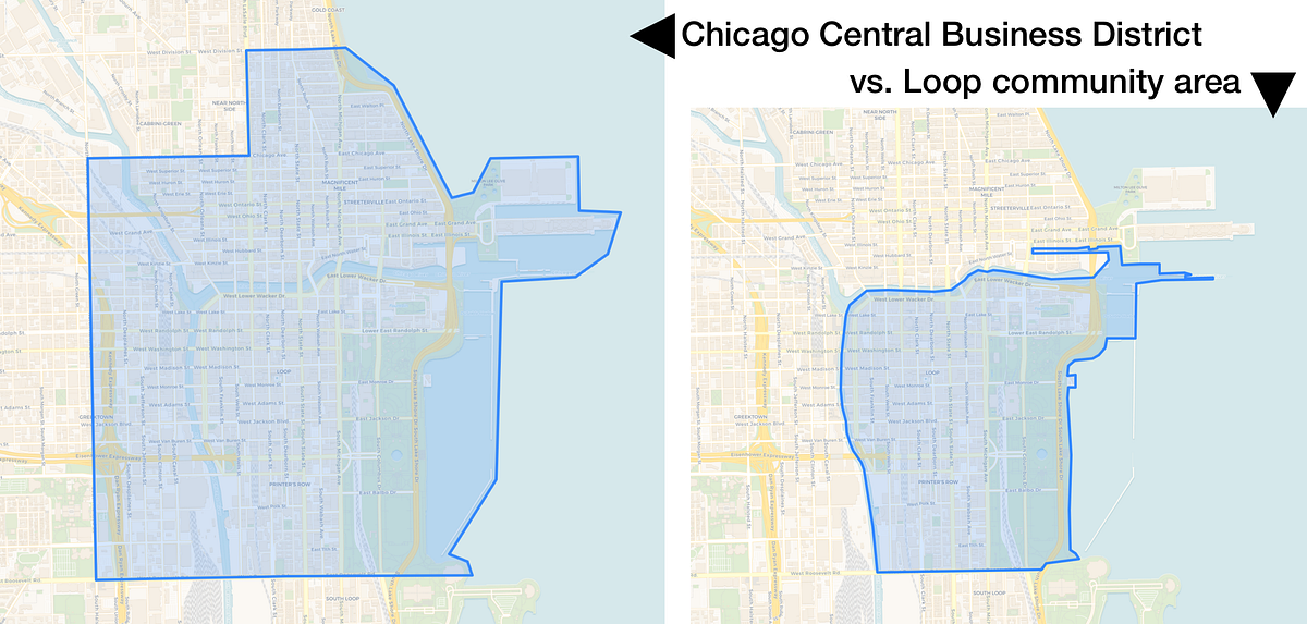
The “Central Business District” map on Chicago Cityscape is drawn based on the boundaries defined in the Municipal Code of Chicago, which makes it an official boundary. It’s defined in the city’s “vehicle code”, 9-4-010 Definitions:
“Central Business District” means the district consisting of those streets or parts of streets within the area bounded by a line as follows: beginning at the easternmost point of Division Street extended to Lake Michigan; then west on Division Street to LaSalle Street; then south on LaSalle Street to Chicago Avenue; then west on Chicago Avenue to Halsted Street; then south on Halsted Street to Roosevelt Road; then east on Roosevelt Road to its easternmost point extended to Lake Michigan; including parking spaces on both sides of the above-mentioned streets.
The CBD is referenced in several other parts of the Municipal Code. The Municipal Code doesn’t define the “Loop” directly, but does define it as a neighborhood boundary in “Exhibit B”, referenced in 1-14-010.
The area is automatically calculated by GIS based on the map you see on the Central Business District page; it will be a bit inflated because the boundary includes a lot of water, although the official boundary stops at the edge between land and water. I drew it loosely because drawing along the edge between land and water is tedious.
“The Loop” is one of the 77 official community areas but it can also refer to the elevated ‘L’ trains that make a loop in downtown. Here’s a map of the Loop, the area of which is calculated 1.66 square miles.