Comparing houses & apartments is one use for new “Amenities”
It’s no mystery that Chicago Cityscape is an effective property research tool because of how it integrates data from dozens of sources. Today, I’m announcing that a brand new dataset has been added that helps homebuyers, apartment shoppers, small business owners, and property developers gain a better understanding of what they or their tenants will have access to.
It’s called “Amenities” and it summarizes and maps where there are grocery stores, doctor offices, restaurants, cafés, bars, and parks within a one mile walk of any address that you look up in Chicago. It’s similar to WalkScore, which measures and compares the ability for one to meet their daily and lifestyle needs by walking, but Amenities’s primary function is to quickly show whether the category of place you need (grocery store) is close by.

Based on feedback from our members, we would consider increasing the walking distance limit, and broadening the types of businesses our system looks for. Should we symbolize the map markers by category, or leave all the businesses looking the same? Leave a response on Medium, on Twitter, or by replying to this email.
Look up an address now or use our example, the Spoke apartments at 727 N Milwaukee Ave.
Data sources
With any service like this, that looks for nearby local businesses, it’s only going to be as good as where the information comes from. Most websites use Google’s Places database, because it has gobs of information about all kinds of businesses and places around the world. It also costs gobs of money to access.
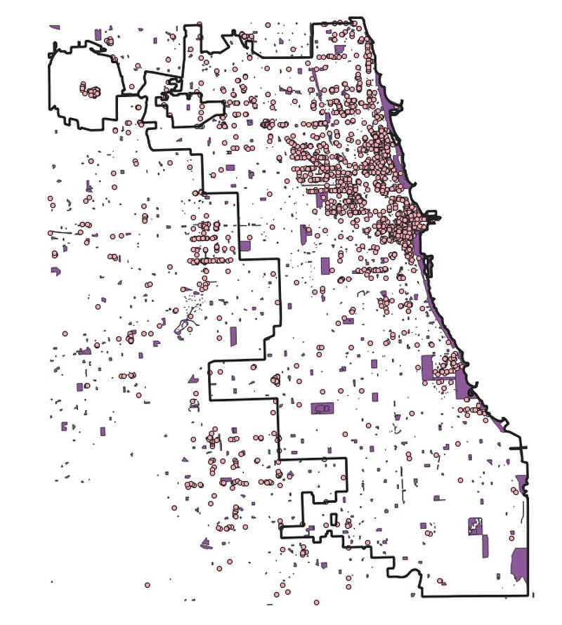
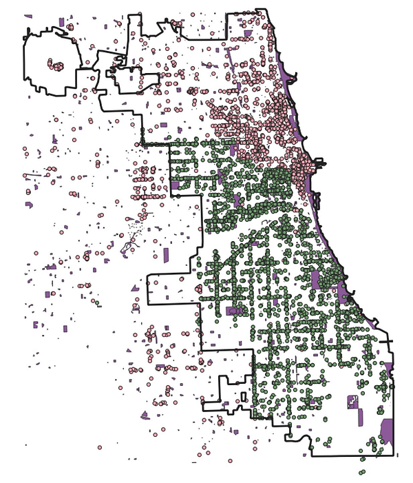
In much of Chicago, we’re using data from OpenStreetMap, the world’s only free database and map of places, maintained by local volunteers.
In other parts of the city, we’re using data that we purchased from MAPSCorps, a non-profit organization based in Hyde Park which employs teenagers each summer to develop and update a census of businesses.
The following two maps clearly indicate why OpenStreetMap was insufficient for the new Amenities service to rely on; having a partial dataset of businesses in Chicago is also part of why it took so long to develop this functionality.
The city’s business licenses database, which Chicago Cityscape maps separately, doesn’t have the kind of categories the Amenities service needs; for example, it’s not possible to distinguish a grocery store like Aldi, Jewel, Cermak Produce, or Pete’s Fresh Market which sell a full range of items, from a corner store or bodega which also sells groceries.
Contact us if you notice a missing or miscategorized business.
Note that for the time being, in community areas near the Loop, there may be some double counting of places because they may be stored in each of the two datasets.