Work in industrial real estate? Chicago Cityscape does, too
Published on Jan. 29, 2020 by Steven Vance
Updated on Feb. 11, 2020
After listening to Mary Ludgin, head of global research at the investment advisory firm, Heitman, speak last week about the relative stability and growth trajectory of the industrial sector in the real estate industry…I knew Chicago Cityscape needed to evolve. Mary went on to say that new warehouse are snapped up right away, and that companies are trying to get closer and closer to the final delivery point.
Cityscape has long been a go-to resource for anyone who needs to look up property information from disparate sources in a single place, providing up to date information on mostly residential and commercial development activity.

Then, an interview with David Doig on WTTW last night reminded me that, “as far as transportation goes, this region is unparalleled.” David, head of Chicago Neighborhood Initiatives, was espousing the benefits of locating manufacturing and distribution businesses in Pullman. He said, “our economy is moving toward getting stuff from point A to Point B as quickly as possible”, and that “Pullman is perfectly set to take advantage of that.” Pullman is near where several railroads, interstate highways, and the Illinois International Port District intersect.
Chicago Cityscape is expanding to provide data and policy awareness in the industrial, warehousing, and logistics sectors.
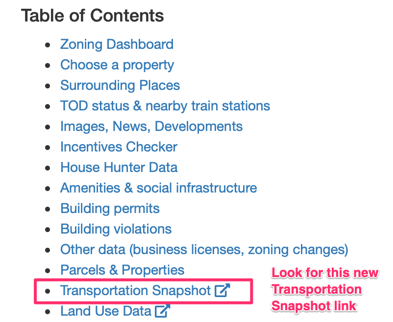
The change started quietly last week when transportation resources and data were separated from Address Snapshot into its own “Transportation Snapshot” webpage. Look for the “Transportation Snapshot” link in the table of contents of the requested Address Snapshot report.
Transportation Snapshot was enhanced to locate the three nearest intermodal yards, their maximum driving distance from the looked up address, and their statistics on the number of annual container “lifts”. Chicago Metropolitan Agency for Planning provides that data. The official regional planning organization has a focus on freight development in the region, given our status as a national hub for transportation.
For example: Widget makers can now use Chicago Cityscape to review data that could show if a location is good for the factory’s logistics needs. This is in addition to our Incentives Checker that may highlight some financial incentives for new or expanding commercial or industrial businesses in Cook County.
What’s next for Transportation Snapshot
Each of the four existing Transportation Snapshot features can be used by planners and managers in several industries:
- Mobility Score can describe how well a location is connected with transportation options for its workers.
- Ride hailing activity maps can demonstrate the relative activity of running errands and going out, as well as hint at income levels, in a target market geography.
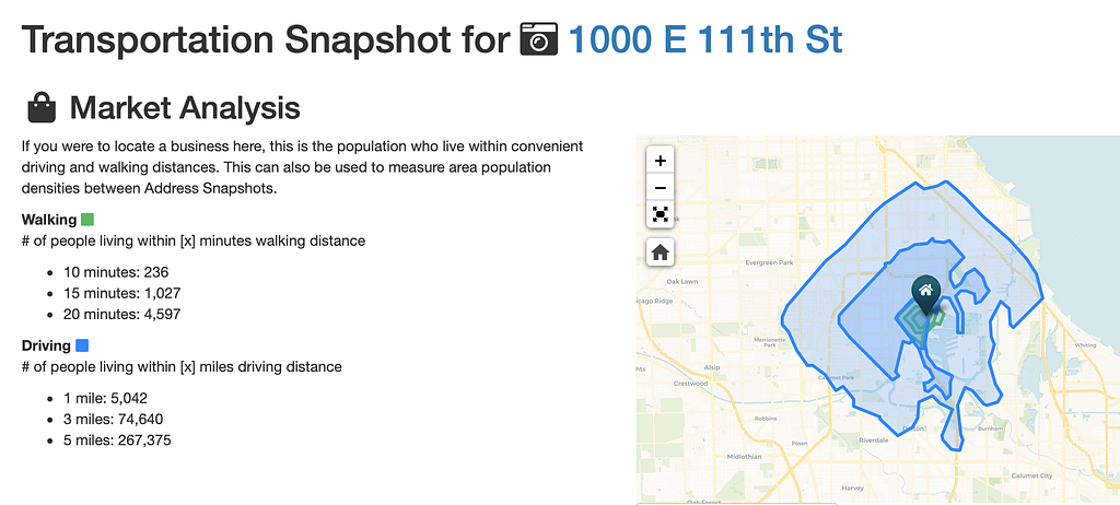
- Population within “x” walking/driving distance is a market analysis tool to help businesses gauge how many nearby customers they might have, or to determine how many people live in a warehouse’s delivery zone.
- Knowing that there are intermodal yards can be a factor in deciding where to locate a widget maker that needs access to national shipping lines.
We’re planning new features as well, including:
- Commuting data that depicts the transportation modes people use to get to workplaces on a given block. Since added!
- Transit lines and extensions proposed and under construction (granted, this isn’t a significant development in our region, but there are new rapid bus lines planned that could change how people get to work), with data provided by Transit Explorer 2.
- A map of nearby CREATE projects, a program to speed up freight rail.
- What do you think we should add to Transportation Snapshot?
Work in industrial real estate? Chicago Cityscape does, too was originally published in Chicago Cityscape on Medium, where people are continuing the conversation by highlighting and responding to this story.
Other posts by Steven Vance full archive