Find historical imagery for Cook County addresses
Published on Apr. 27, 2021 by Steven Vance
It’s not well known, but Cook County obtains aerial imagery of the whole county every year or two. These are obtained from cameras on planes, and the images are higher resolution than those taken from satellites.
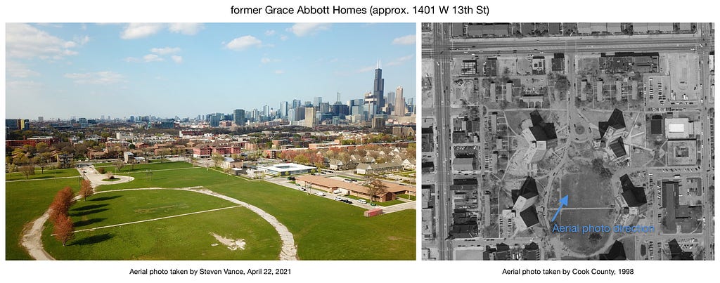
Chicago Cityscape offers everyone who looks up an Address Snapshot for a Cook County location an easy switch to see historic imagery going back to 1998. That may not seem that old, but a lot of land has changed in the last 23 years. The difference is especially noticeable if you look at where all of Chicago Housing Authority buildings were demolished, some of which I’ve featured in these “before and after” images above.
You can switch between 1998 and 2019, and there is historic imagery from 10 intervening years. Here’s how to do it:
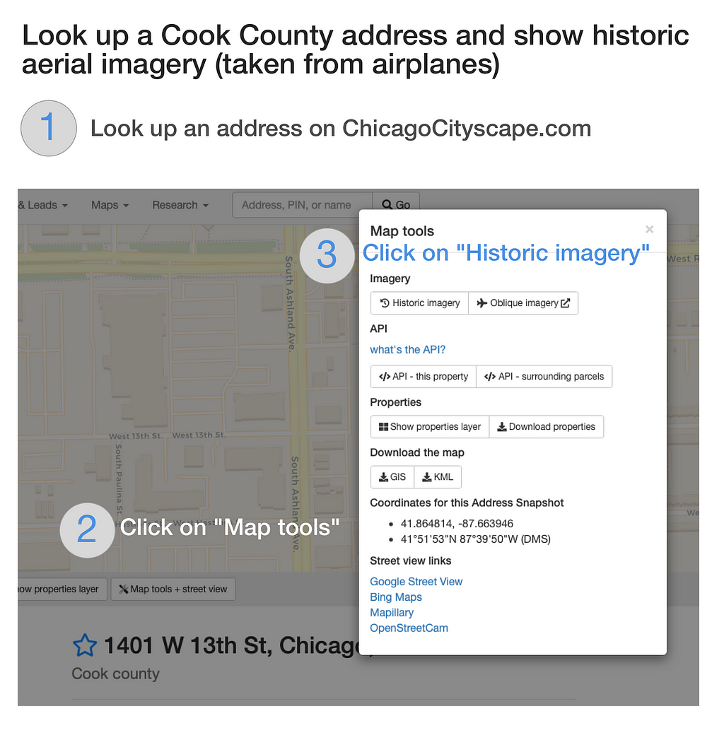
(1) Look up an address, (2) then click “Map tools” below the map, and (3) finally click “Historic imagery”.
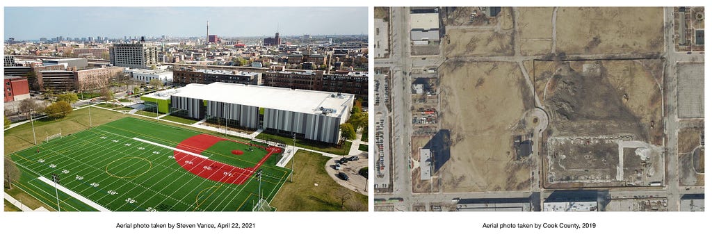
Just south of the grassy field of the former Grace Abbott Homes is a new sports field and fieldhouse for Jane Addams Park.
Find historical imagery for Cook County addresses was originally published in Chicago Cityscape on Medium, where people are continuing the conversation by highlighting and responding to this story.
Other posts by Steven Vance full archive