Update: This version of Property Finder was deprecated and replaced with multiple topical Property Finder maps.
A friend of mine was interested in finding a place where she could locate a new business she wanted to start. The type of business can only be located in an M zone, and inside of a pretty large building. They tried using commercial real estate listings websites but found inaccurate information, and outdated listings.
My friend turned to Chicago Cityscape for help targeting her search to specific parts of the city to either find a worthy property herself, or assist an broker by narrowing the candidate properties and locations to ones that would actually work for her business.
We redesigned Property Finder to make it easy to find developable land in Chicago and Cook County using your personal search criteria.
You can search for vacant land, occupied land, land owned by the city or the Cook County Land Bank Authority, parking lots, or suspected brownfields — all of which are open sources of data.
We cannot include CRE or other real estate listings because those are proprietary databases.
You can filter the results by zoning (Chicago only), land area, and distance to CTA and Metra stations. You can filter Cook County parcels by property classification, assessed value, and the cost of its most recent tax bill.
Use Property Finder to quickly focus your search for developable land.
Examples of how to use it:
- Search for vacant land within two blocks of CTA stations in Chicago, which are eligible for density bonuses and parking minimum reductions
- Search for all mixed-use zoned, city-owned land near CTA and Metra stations in Chicago
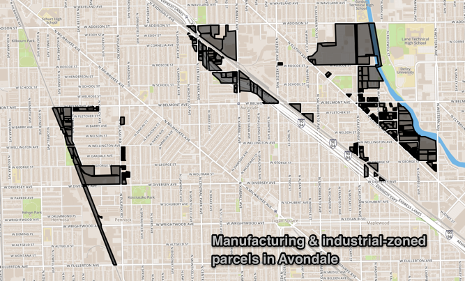
- Search for industrial buildings or zoning districts in Avondale, Pullman, or any ward, neighborhood, industrial corridor, community area, and TIF district

You can use Property Finder for research, too. We looked up how many single-family houses are located around CTA stations, because of how zoning can restrict housing production, especially near transit stations where the highest allowed density should be set.

Finally, you can save searches to your account so that you can reference them later, and download them as a map for GIS programs, or as a spreadsheet. All of our export features require a Pro membership, and we’ve increased our free trial period from 14 days to a full month.
We’re always looking for your feedback on our tools — please contact us if you have any questions on how to use Property Finder, or have a suggestion to improve it.