Ten new features to start 2023
Published on Jan. 4, 2023 by Steven Vance
We’ve got 10 new features to show off, added in 2022 Q4. There’s something for every one of our members: new features to Property Finder, new ways to find already-upzoned properties, ZBA decisions, affordable housing data, new incentives, and Red Line Extension info.
Join us on Wednesday, January 25, 2023, at 12 PM for Lunch Break Update, when we’ll demonstrate some of these features live and have an open discussion with existing and prospective Chicago Cityscape members.
RSVP today to get the Zoom link

ChiBlockBuilder
Property Finder incorporates 2,000+ city-owned properties for sale, part of the new ChiBlockBuilder program. That means you can layer so many filters and apply them to only the ChiBlockBuilder properties for sale. Filters like proximity to transit and certain incentives.
Read about ChiBlockBuilder in our previous article.
Standard 6-3
The Connected Communities ordinance — a big revision to the longstanding transit-oriented development part of the zoning code adopted in 2022 — effectively doubled the allowable density on nearly 10,000 standard size lots in several neighborhoods. This works in RM-5+ zoning districts by removing parking minimums, allowing all the units the zoning district allows to be built without trying to figure out how to stash more than three car parking spaces on a 25-feet wide lot.
With one click in Property Finder, Chicago Cityscape can locate all of these lots. Our previous article demonstrates how to use it, and we have a Knowledge Base article with a tutorial and examples.
Two additional years of property sales
Chicago Cityscape has added property sales data in Cook County for 2014 and 2015. This means our database has just under 1 million property sales records. There were 78,360 sales in 2014 and 84,616 sales in 2015.
As soon as we integrate 2022 Q4 — in about two weeks — the database will have over 1 million property sales records. Can you believe that there have been that many transfers in Cook County in nine years?
Super Parcel + Housing Recalculator are easier to use
Super Parcel and Housing Recalculator have evolved how some of our residential development-focused members work (that’s what a few of them have told us!). Members use Super Parcel to virtually assemble multiple lots — up to ten — into one after which Zoning Assessment will calculate the number of dwelling units allowed.
Then, they use Housing Recalculator to modify the actual zoning district to a proposed zoning district and see how many dwelling units would be allowed in the future.
Super Parcels can be created more easily, both in the map and the data table. In the map, click on each parcel you want to include and select the checkbox. After choosing two, links to that Super Parcel will appear both above the map and above the data table. (Read the full tutorial.)
Housing Recalculator has also been updated to allow for calculating the residential zoning capacity of a lot even if the current zoning district doesn’t allow housing (DS, M, PMD, and PD zoning districts).

Property Finder improved with new visuals & filters
Property Finder has been updated with four new abilities: it loads automatically, parcels are symbolized according to their property classification and Chicago-owned land status, the filters have been rearranged by theme, and housing capacity is calculated on the fly.
- Property Finder is the feature our members use most, so it makes sense to load that front and center each time a Place Snapshot Report is opened. This will take effect on the next time you sign in and can be disabled by adjusting your preferences.
- By request: The meanings of the parcel colors are now shown in a map key, and Chicago-owned land and ChiBlockBuilder land are shown with dashed outlines to make them easier to spot.
- Property Finder filters have been thoroughly reorganized. The filters have been arranged into three themes. Many of the lesser-used ones are behind collapsed titles; click on a title to expand and display the filter.
- Property Finder can also be told to calculate the number of dwelling units allowed at every Chicago property. Either filter by zoning district or select the “Show zoning & housing units” button (learn more).
Zoning Board of Appeals decisions
Brand new: Chicago Cityscape has added 50 years of Zoning Board of Appeals decisions to Chicago-based Place Snapshot Reports. This includes nearly 16,400 applications for variations, special uses, and administrative adjustments. (Not a member? Preview this area of North Lawndale.)

What’s ZBA? The Zoning Board of Appeals is an independent body appointed by the mayor who review and approve certain proposed developments or changes to existing developments that the zoning code doesn’t allow as of right. The most common approval property owners seek is to reduce setbacks (it’s so commonly approved that it might make sense to change Chicago’s setback standards).
Updated data
Chicago Cityscape updated five datasets:
- Demographic information in Lending & Investment Snapshot was updated to grab data from the latest 2017–2021 five-year American Community Survey.
- Amenities and social infrastructure was updated to add new businesses and remove closed businesses since September 2022. The geography was also expanded to include all of Cook County and the closest counties in Indiana (where the South Shore Line runs). Look for this section in both Place Snapshot Report and Address Snapshot Report.
- Building footprints were updated to include the latest outlines of large buildings where it may be possible for some members to locate where solar panel arrays could be installed.
- HUD’s Fair Market Rent data for 2023 was added, which advises landlords and affordable housing developers on how much rent the federal government and local public housing authorities will pay for households that have a rent voucher. In Address Snapshot Reports.
- By request: we’ve added reports to 311 of potential building violations to each Place Snapshot Report and Address Snapshot Report. This helps some of our members identify where renters may need additional support to deal with substandard housing.
Affordable housing data updates
Chicago Cityscape has updated the Qualified Census Tract and Difficult Development Area maps for 2023. This information is necessary to identify potential sites for residential developments that would be co-funded by low income housing tax credits (LIHTC).
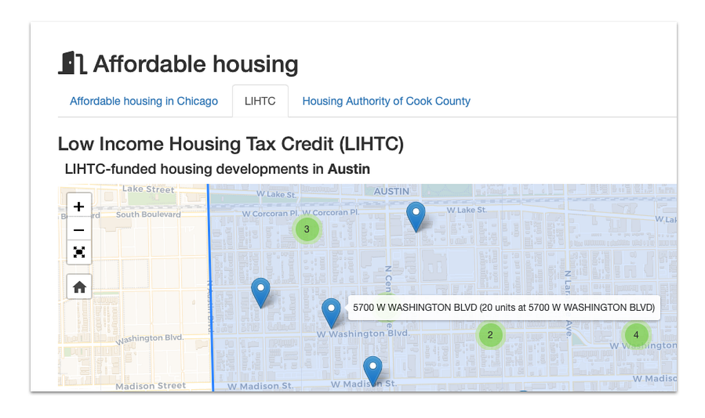
Additionally, we added 22 LIHTC-funded residential developments to our statewide map of where affordable housing is. This information is useful for applications for LIHTC funding approval in order to avoid an overconcentration of affordable housing developments. You’ll find these locations in the “LIHTC” tab of Place Snapshot and Address Snapshot.
Two new incentives
Incentives Checker has two new incentives and development assistance programs. All but three Industrial Corridors in Chicago are able to receive money from the Industrial Corridor System Fund for infrastructure modifications, business improvement grants, and job retention. Incentives Checker will highlight if an Address Snapshot Report is in one of these Industrial Corridors.
One more thing: the Red Line
Now that the City Council has created the local funding source for the construction of the Red Line Extension, it makes sense to highlight five new Place Snapshot Reports that you can use to find city RFQ/RFP opportunities, local incentives, and vacant land owned by the city or in the Cook County Land Bank Authority’s inventory.

Use one of the five Place Snapshot Reports below, then use Property Finder to locate “government-owned” land or property that is in a specific incentive geography.
- Open the Red Line Extension map if you’re interested in everything around the 5-mile-long route
- 103rd (400 West) station map
- 111th (400 West) station map
- Michigan (11500 South) station map
- 130th (1200 East) station map
Next steps
- RSVP on Zoom for our Lunch Break Update on Wednesday, January 25, 2023, at 12 PM.
- Start a free trial of Chicago Cityscape’s Real Estate Pro membership
- Request personalized coaching
Ten new features to start 2023 was originally published in Chicago Cityscape’s Blog on Medium, where people are continuing the conversation by highlighting and responding to this story.
Tags
Click a tag to find more posts.
- quarterly_update (14)
Other posts by Steven Vance full archive