Chicago Cityscape now has an updated copy of the Chicago zoning map, which replaces the previous map from December 2017. The map reflects 29 different zoning changes and 20 Planned Development adoptions made between December 2017 and February 28, 2018.
This means that we have a new snapshot for zoning history for addresses and parcels in Chicago. If its zoning changed between December 2017 and February 2018, you’ll see what that location’s zoning district is now and what it was changed from.
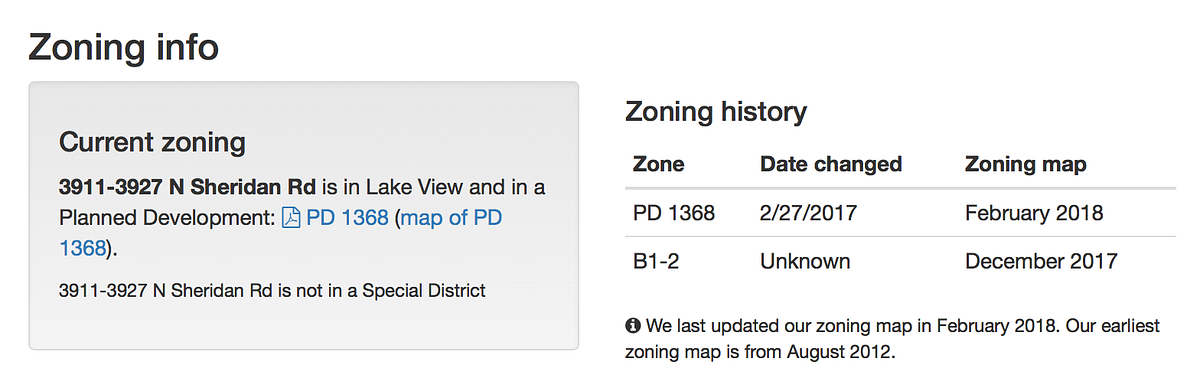
For example, if you look at 3911 N Sheridan Road in Lakeview you’ll see that the Planned Development #1368 was adopted in February 2018, and that prior to this the building was in a B1-2 zoning district.
It also means that when you look at the Zoning Assessment map for a community area, ward, ZIP code, or a Place that you draw yourself, you’ll see the latest zoning districts.
The Zoning Assessment map will also show the current statistics on how much any given Place is covered by a particular zoning district. This was designed to be able to see how much an area was covered by single family-only zoning, or zoning that allows multi-family housing.